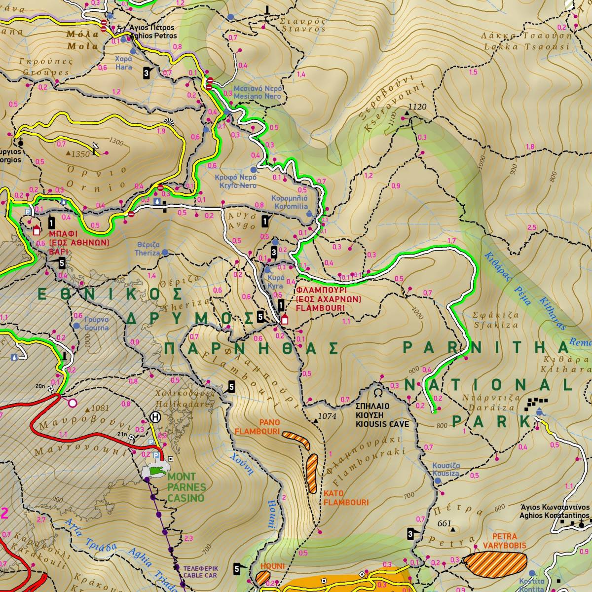
Discover Mt. Parnitha like never before with TERRAIN’s detailed hiking and outdoors map. Covering 362 kilometers of walking trails, this map is the only one to feature every footpath and trail with precise point-to-point distances, helping you plan routes and accurately estimate hiking times.
It also marks all climbing sites with their access points, the bolted canyoning route in the Goura Gorge, motocross training areas, and much more. Scenic mountain routes are clearly highlighted, making it easy to choose the most rewarding paths for your adventure.
Presented on the reverse side are detailed instructions for 8 of the most beautiful hikes in Parnitha, of all levels of difficulty.
Also features is a detailed map of the Tatoi Estate at a scale of 1:10,000, marking the 36 major attractions as well as all the paths that cross the estate.
Sample