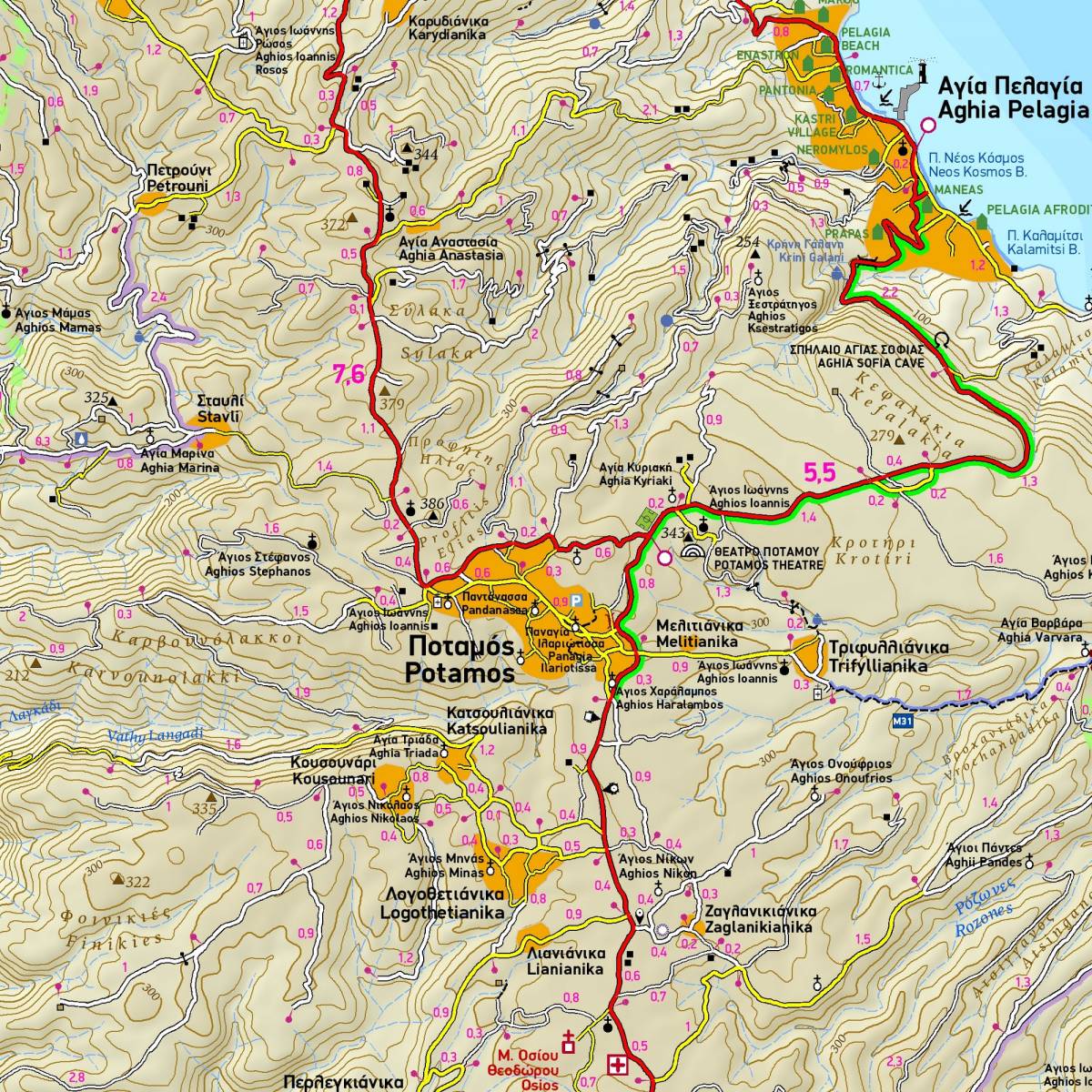
The 4th edition of TERRAIN’s hiking map of Kythera has been completely redesigned, and is enriched with new and updated information collected exclusively in the field from across the whole island.
It is the only walking map of Kythera which accurately depicts the major footpaths and trails (totalling 69 kilometres) of the island, using point-to-point distances in km. All the signposted hiking routes of the Kythera Trails network are shown using blue colour shading and their numbers, while the island’s canyoning routes through its gorges are marked using a special symbol.
On the back of the map you will find information about hiking on the island, including descriptions of the waymarked trails. Also featured is a guide to Kythera’s history, nature, beaches, and most notable cultural and historical sights.
Also to be found on the back of the map is a detailed map of the island’s Chora, showing all its shops, hotels, restaurants, cafes, bars, churches, the castle and the places of interest to see in the village and its environs.
Sample