The cosmopolitan island of Hydra is not known to many for its walking trails, it is however the ideal island to explore on foot! It has preserved all its old paths that run through the entire island from one end to the other, revealing a charming side of Hydra that few know.
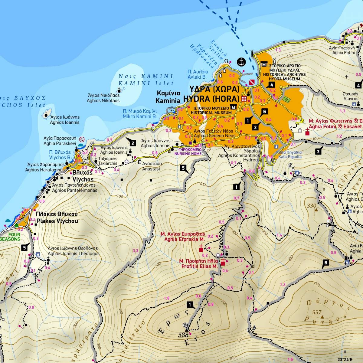
TERRAIN's fully updated 1:20,000 scale Hydra sightseeing and hiking map has been updated with a sweeping field survey that has recorded many new trail sections that have been cleared on the island. All the trails are marked with point-to-point distances. Thus, hikers can compose the route they are interested in and calculate the length and duration of the hike. The 6 recommended hiking routes of the island are marked with distinct gray shading and a numbering symbol. On the reverse side of the map, there is a detailed hiking guide with detailed descriptions and data (total length, walking time, total ascent, total descent) for these 6 hiking routes.
Like all TERRAIN maps, the map accurately and clearly captures all the sights, beaches, monasteries of Hydra. Also included is a detailed map of the town of Hydra, at a scale of 1:3,000, with all hotels and guesthouses, restaurants, museums, churches and many other points of interest marked.
On the back of the map there is a brief travel guide with photos and information about the history and natural environment of Hydra.
Note: In theory, there is a network of 5 marked hiking trails in Hydra, but in reality it is unclear which these trails are, and their markings range from incomplete to non-existent. The routes shown on the map largely but not completely coincide with those of the official network.
Sample