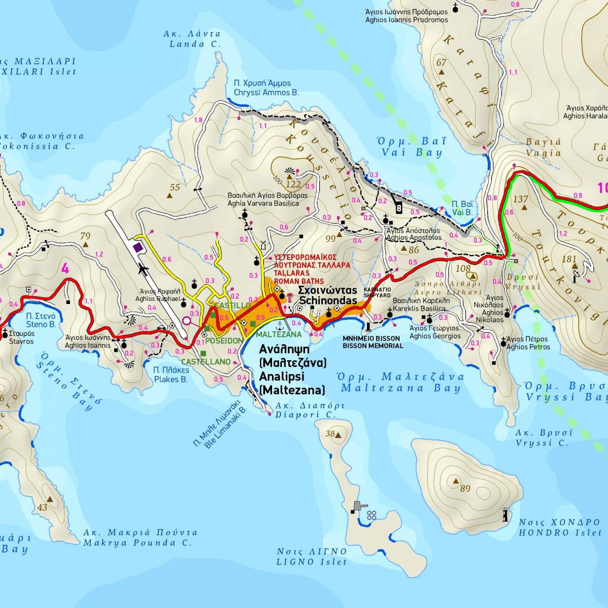
The 2nd fully revised edition of TERRAIN's Astypalea hiking map has been updated with sweeping field research and with the cooperation of local hikers. Many new trails have been added, and although signage on the island remains rudimentary, this map will help you hike comfortably and safely to every corner of the island.
It is the only hiking map – guide of Astypalea that depicts all the paths of the island with point-to-point distances, allowing hikers to compose and plan their own routes. There are 11 suggested hiking routes on the island, distinctly marked on the map with color shading. On the reverse side of the map there are detailed descriptions and data (total length, walking time, total ascent, total descent) for these hiking routes, so you can choose the one that suits you.
In addition to the walking trails, the map depicts with accuracy the entire road network of the island, distinguishing between paved and dirt roads, all the beaches and all the attractions of the island. On the reverse side of the map there is a detailed map of the Chora of Astypalaia, on a scale of 1:4,000, with all the points of interest marked.
On the reverse side of the map there is a concise travel guide with impressive photos and information about the most beautiful beaches and the most important attractions of the island, as well as about the history and natural environment.
Sample