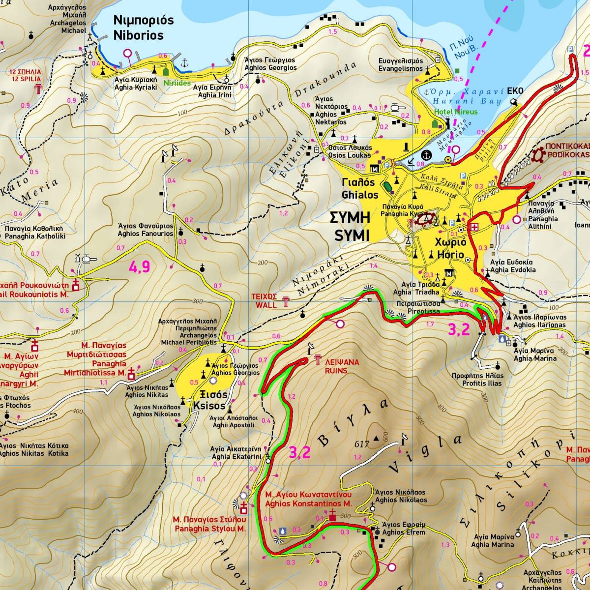
Mostly known for its stunning traditional town, Symi has a lot more to discover. This contoured GPS-compatible hiking map of Symi at 1:20.000, clearly depicts all roads, walking trails, beaches and places of interest. All paths are accurately marked with point-to-point distances so you can plan your route and estimate walking time.
On the reverse side there is extensive tourist information about the island’s history, natural environment and the most important places to see. Also included is a presentation of the the 10 best hiking trails on the island, with detailed descriptions, total distance and hiking time.
For those interested in rock climbing, the map depicts the climbing crag located on the mountain Dysalonas, and there is an information section with details of all the climbing routes in this area on the back of the map.
Sample