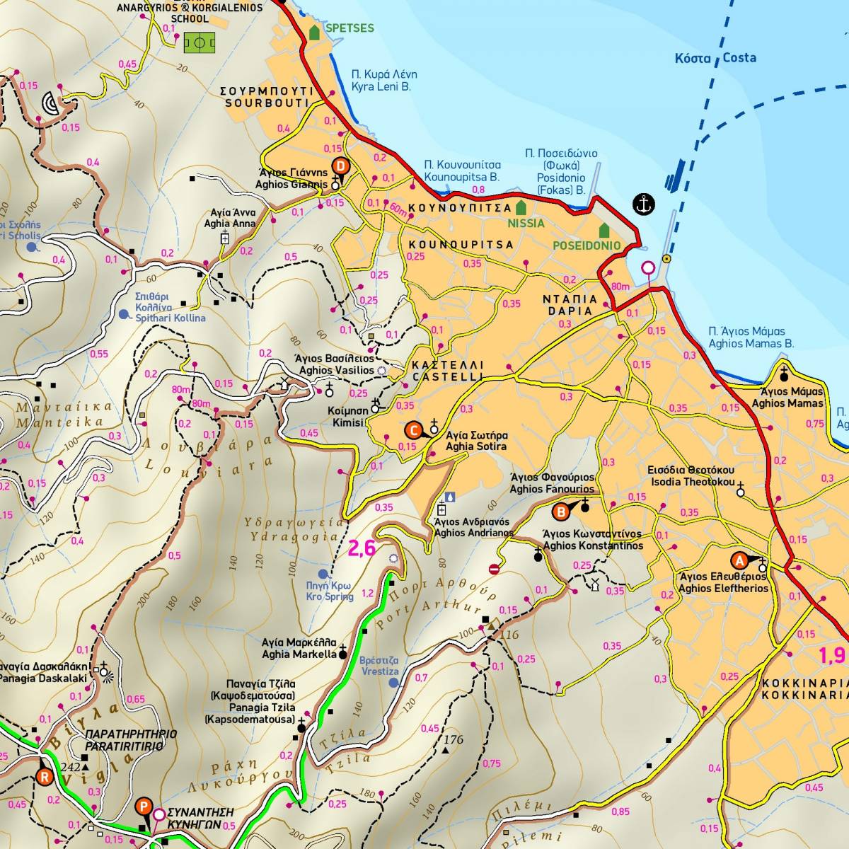
With a detailed scale of 1:12.000, this hiking map of Spetses depicts all the footpaths and trails with accurate point-to-point distances. There are 12 recommended hiking routes which are marked on the map with a brown shading, so you can easily follow them. Waymarking on the island is scarce, so this map is an essential tool for your walking expeditions.
One of the main draws of the island of Spetses is without doubt its historic and picturesque town, with its old harbour, museums, churches, centuries-old shipyards and the mansions which were built by the islands’ seafaring captains. Shown on the reverse side is a highly detailed town plan of Spetses, marking all the hotels and guesthouses, restaurants and cafe-bars, shops and car-bicycle rentals, plus all churches, parks, museums, monuments and places of interest.
Sample