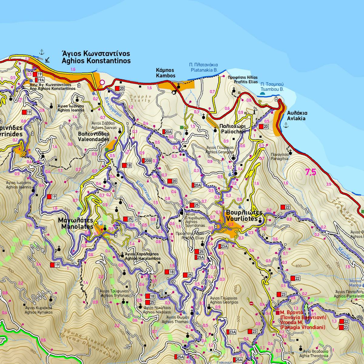
This fully updated hiking map of Samos in the detailed scale of 1:30.000 is the official map of the “Samos Hikes” network, a network of 240 km of signposted hiking trails developed by TERRAIN TRAILS on the gorgeous island of Samos in 2019-2020 (www.samoshikes.gr). All of the 40 hiking routes in the Samos Hikes network are clearly and accurately depicted on the map, using colour shading and numbering signs. Also included is a comprehensive table with all the essential information for the marked trails (location, number, start/end points, length, hiking time) as well as ta reference map of the whole network.
As with all the hiking and touring maps published by TERRAIN Editions, an amazing wealth of information is shown.
• All hiking trails, including non-marked ones, graded between main and narrow trails and indicated with point-to-point distances, to help you plan your own hiking itinerary.
• The complete road network, including the dense network of forest roads in the mountainous inland of Samos
• All the beaches, even the most remote ones
• All places of interest, cultural, historical and natural sights.
Sample