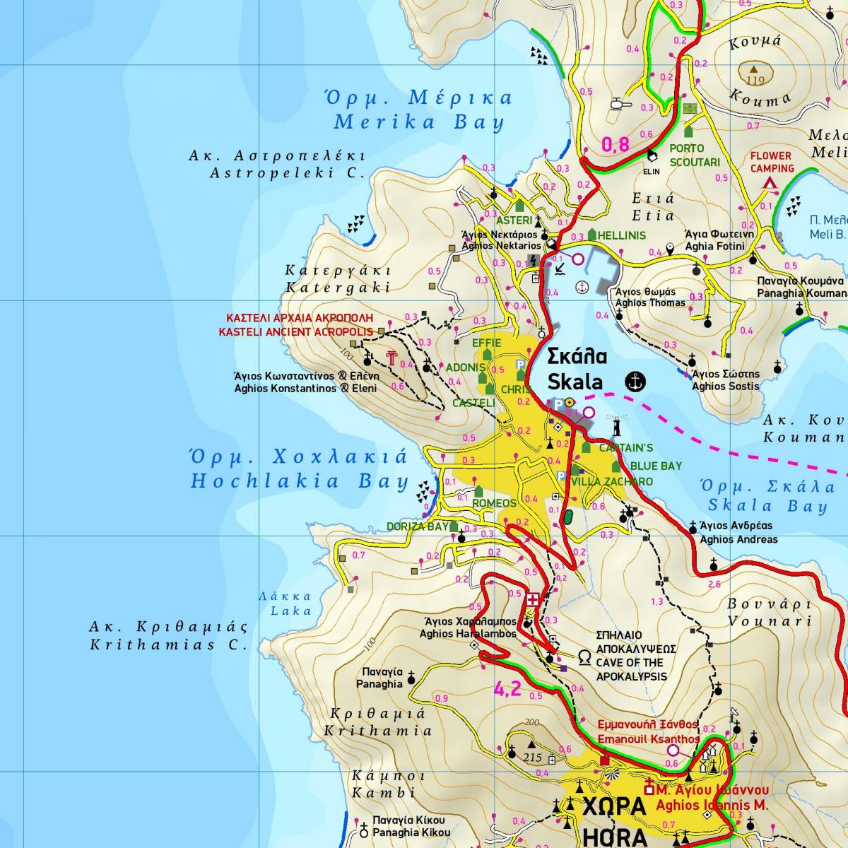
Although Patmos is a small island with a land area of just 34 square km and a coastline approximately 70 km long, it counts more than 90 beaches! Each and every one of them is depicted on this hiking map of TERRAIN with their special features, whether it is sandy or pebbled, whether it features natural tree shade, water, a beach bar or organized water sports, whether the seabed in front of the beach is sandy or rocky.
This map is ideal for exploring and walking: The whole island's road network is portrayed with high precision and scenic routes are picked out with colour shading. Also shown are the paths which criss-cross the island, and which take you to secluded beaches and places of interest.
On the back of the map you will find a concise travel guide with information on the mythology, history, natural environment, and of course the most important places to visit on Patmos. You will also find a detailed map of Scala, the port of Patmos on a scale of 1:2.500.
Sample