Hiking map Scale 1:20.000 2009 Edition
Printed on Polyart
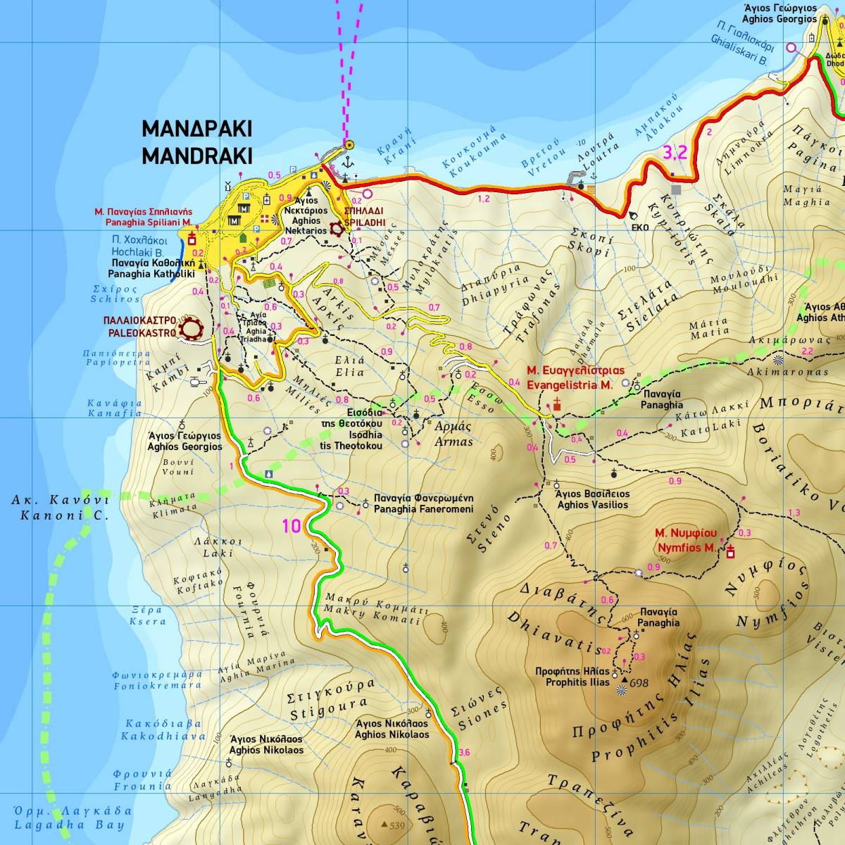
This is the first ever walking map for the beautiful volcanic island of Nisyros, and is also the most comprehensive one available. It depicts the entire road network of the island, all its beaches, as well as all its historic and archaeological sites. It includes a map of the main village Mandraki, where the island’s port is located, on a scale of 1:3.500. On the back of the map there is a concise travel guide with lots of photos and information on the mythology, history, natural environment, and the most important sights to see on Nisyros.
For those interested in hiking there is an extensive information section with detailed descriptions of 11 walking routes to be found on the back of the map.
Sample