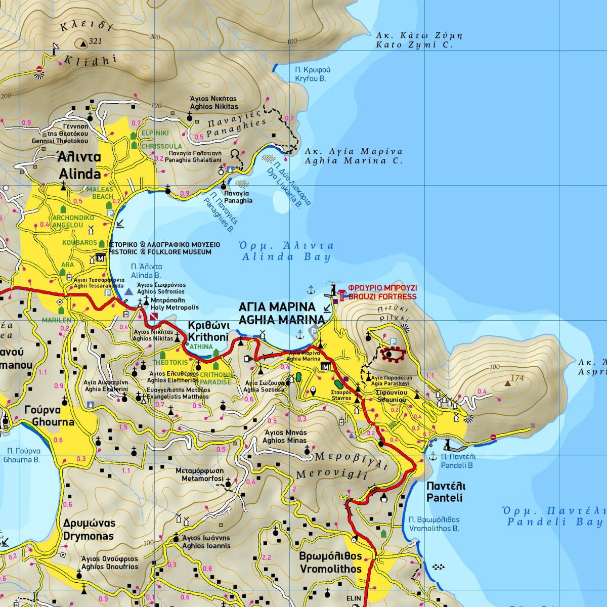
TERRAIN’s map of the island of Leros at a scale of 1:25.000 is the only GPS-compatible hiking map available for the island.
Hiking trails are graded between main routes and narrow trails with point-to-point distances marked all over. The whole road network is accurately depicted, clearly distinguishing between paved and dirt roads. All beaches, and all the archaeological sites and places of historic interest are shown.
On the back of the map you will find a concise tourist guide to the island with information on its mythology, history, geology and of course the most interesting sights to see on Leros.
Sample