Touring map Scale 1:45.000 2009 Edition
Printed on Polyart
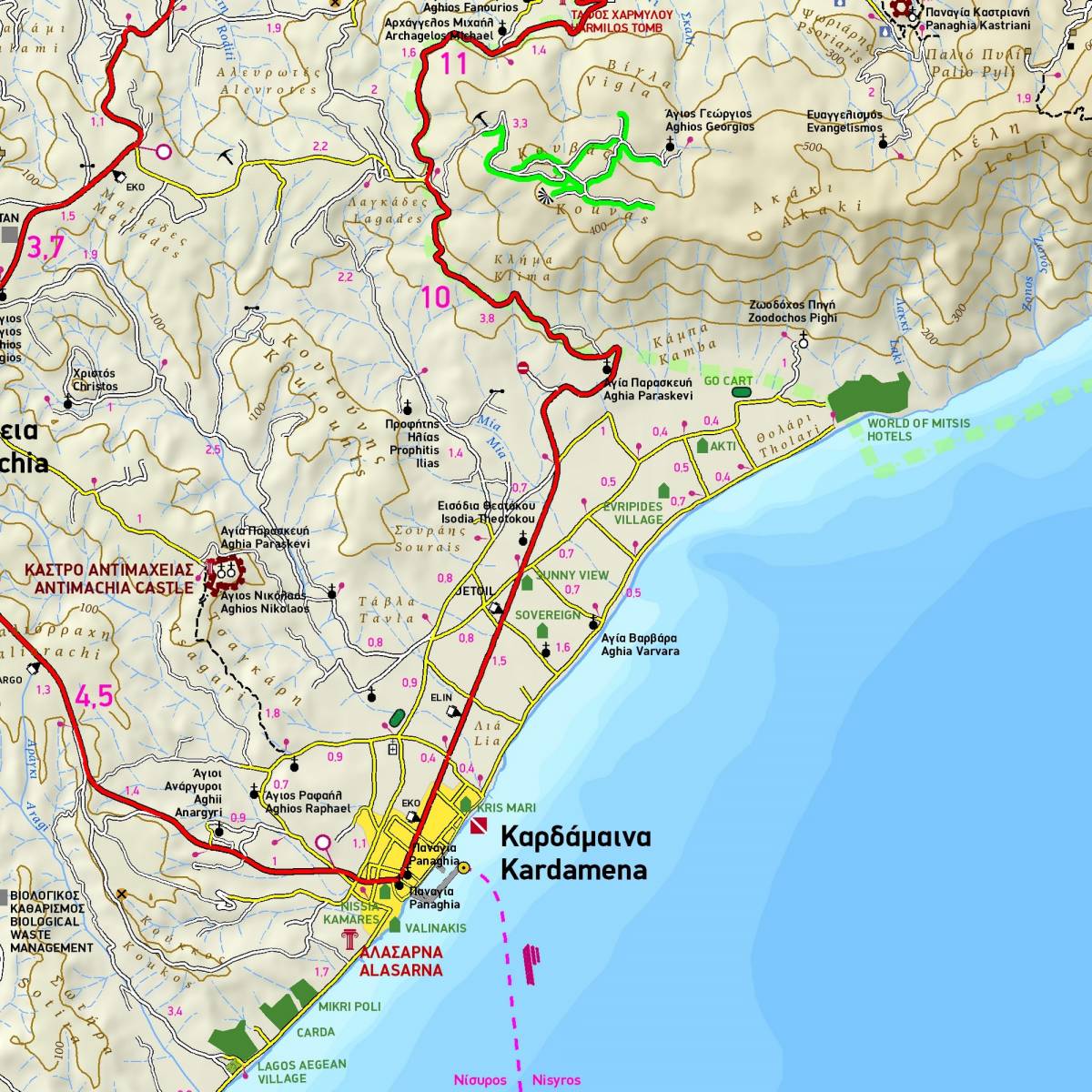
TERRAIN’s map of the greek island of Kos is a contoured GPS compatible map at a scale of 1:45.000. The whole road network is accurately depicted, clearly distinguishing between paved and dirt roads. All beaches, and all the archaeological sites and places of historic interest are shown.
For those interested in hiking this map of TERRAIN depicts the fascinating path which leads to the second highest peak of the mountain Dikaios as well as the path from Kardamaina towards the castle of Antimachia.
On the back of the map you will find a concise travel guide with information on the mythology, history, natural environment, and of course the most interesting sights to see on Kos.
Sample