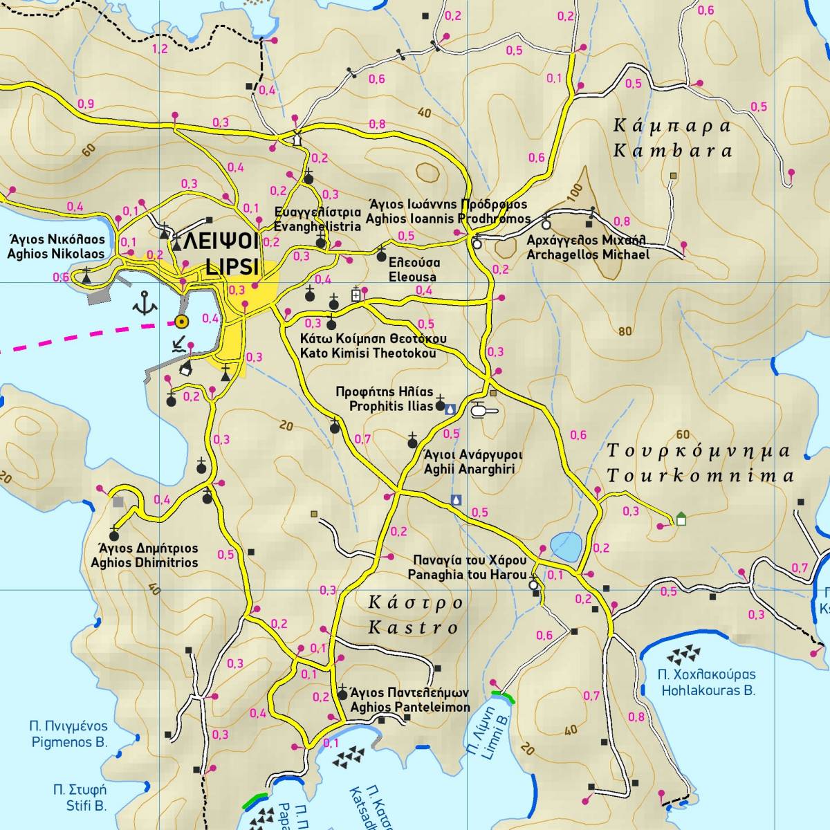
These three small Greek islands and the dozens of smaller islands and rocky islets that surround them are located in the Eastern Aegean. TERRAIN’s hiking map is the first map to depict this delightful island archipelago with its secluded sandy beaches and enchantingly clear seas.
The map depicts the villages, roads and all places of interest for the visitor. Hiking paths are shown with precise distance measurements, graded as main or narrow trails. Also shown in details are all the beaches (even the tiniest cove!) in the archipelago, distinguishing between sandy and pebble beaches.
On the back of the map there is a mini travel guide for each of the islands with information on their history, natural environment, the sites of interest and brief descriptions of their most interesting hiking routes.
Sample