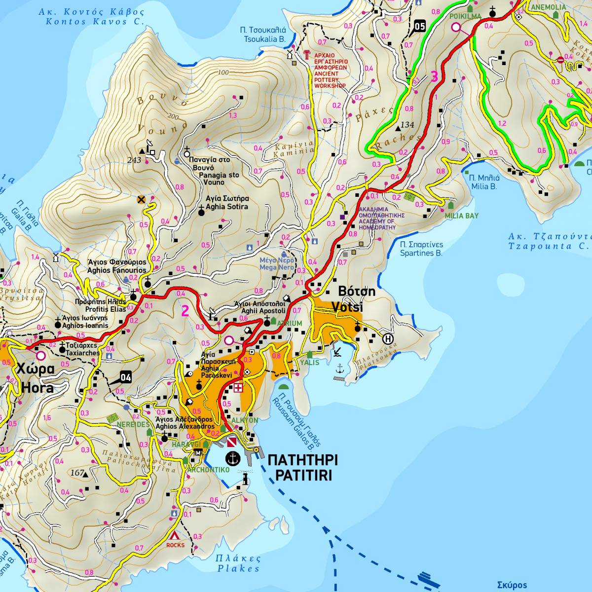
The hiking map of Alonissos in the scale of 1:25.000, is your best guide to enjoy hiking on this verdant island of the Northern Sporades, which retains many of its old walking trails and cobbled paths making it a popular hiking destination in the northern Aegean. All the trails of the island (totalling 58 km) have been recorded with field research and are accurately shown with point-to-point distances. On the back side of the map you will find detailed information for 16 recommended hiking routes (description, total distance, hiking time, difficulty rating).
As in all TERRAIN maps, a wealth of information is depicted, including all the beaches, the complete road network, all sights and tourist attractions. Also included is the neighboring island of Peristera, detailed town plans of the settlements of Hora and Patitiri in a 1:5.000 scale, as well as a concise map of the Northern Sporades National Marine Park.
The reverse side features an illustrated mini travel guide with information on the island’s myths and history, geography and natural environment, and major sights and attractions.
Sample