Hiking map Scale 1:20.000 2009 Edition
Printed on Polyart
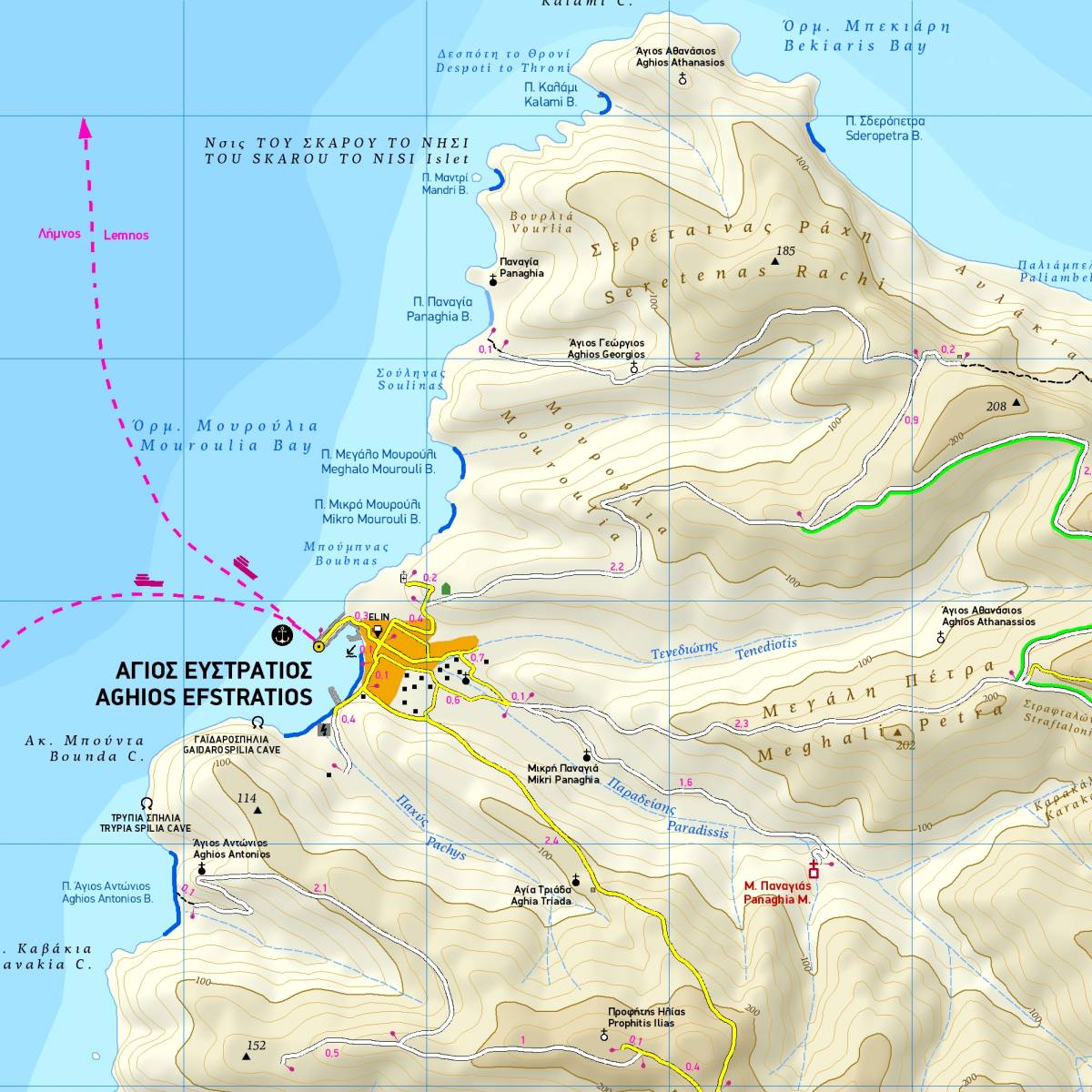
TERRAIN’s hiking map of this tiny remote Aegean island was the first using GIS (Geographical Information Systems) to be published-and remains the only GIS map for the island to this day. It depicts the entire road network, all the beaches and all the sites of interest.
On the back of the map you will find a concise travel guide with information on the mythology, history, flora and fauna and the most interesting sights on Aghios Efstratios. There is also a detailed description of a hiking route along the northern coast of the island, which brings the walker to one of the most beautiful beaches on the island.
Sample